Session Abstracts:

Graduate Student Researcher
Stanford University
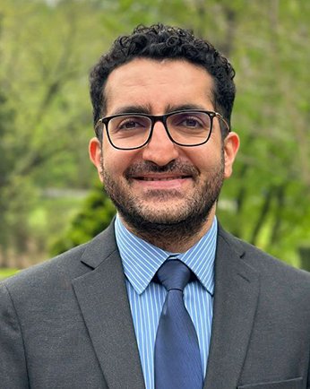
Regional hazard and exposure modeling for wildfire risk assessment
Co-Authors: Neetesh Sharma (Florida State University) and Jack Baker (Stanford University)
Abstract: Wildfires threaten communities worldwide, and recent times have seen increased threats to life and property. Forest management and fire suppression practices have let fuels build up. At the same time, hotter and drier conditions from climate change, and the development in the wildland-urban interface, have increased the frequency of damaging wildfires. Furthermore, human activity and existence of critical infrastructure facilities affect both the occurrence rates of ignitions and the value at risk. Electrical infrastructure is an important component in wildfire risk, as power utility companies have been found responsible for multiple catastrophic wildfires, resulting in devastating community losses. Costs related to wildfire impacts and mitigation have also led to significant increases in power rates. This work aims to model wildfire risk to support risk mitigation and power utility price regulation by simulating wildfire scenarios and assessing their respective losses at the regional level. To model the wildfire hazard, we investigated the spatial patterns of wildfire ignitions over Sonoma County, a historically vulnerable region in Northern California. We then used state-of-the-art software tools to model the spread of wildfire and simulated 7,980 wildfire scenarios. We collected exposure data regarding the locations and physical and financial attributes of structures and power infrastructure assets to assess the liability and replacement losses resulting from the different wildfire scenarios at a regional level. Beyond quantifying the direct financial impact of these wildfire scenarios, estimating the likelihood of ignitions from power infrastructure can inform mitigation actions and potential liability costs in future wildfire events.
Graduate Student Researcher
University of Maryland, College Park
The Role of Social Networks in Shaping Evacuation Behavior: A Case Study of the 2018 Campfire in Paradise, California
Co-Authors: Deb Niemeier (University of Maryland)
Abstract: This study presents a comprehensive analysis of evacuation behaviors influenced by social network characteristics using mobile location data. By employing a robust methodology that integrates data cleaning, social network extraction, and advanced analytical techniques, we investigate how individuals' positions within social networks and their socio-economic statuses interact to affect their responses during emergencies. Our innovative approach, which includes the application of node embeddings and graph convolutional networks within a graph autoencoder framework, captures the complex relationships and structural properties of the network. Our analysis revealed significant variations in evacuation timings across different clusters, each characterized by distinct socio-economic and network attributes. These insights underscore the impact of social and economic capital on emergency response behaviors. The study's findings advocate for emergency management strategies that are tailored to the diverse needs of various community segments, emphasizing the importance of enhancing social connectivity and resource accessibility to improve disaster resilience. This research contributes to the field by demonstrating how integrating socio-economic data with network analysis can offer nuanced insights into community dynamics during emergencies, paving the way for more effective and equitable public safety policies.

Graduate Student Researcher
University of Michigan
Transport of Firebrands using an Eulerian Multiphase Approach to model simulations at Community Level
Co-Authors: Seymour M.J. Spence (University of Michigan) and Ann Jeffers (University of Michigan)
Abstract: Wildfire spread can be attributed to two mechanisms: a traveling fire-front and spot ignition by firebrands. Firebrands are the burning embers transmitted from a wildfire. These embers, once ejected, may travel for distances as long as 20 miles and land while still burning causing ignition and generation of new fire fronts. The current state of the art computational fluid dynamics (CFD) models employ a Lagrangian particle tracking (LPT) scheme to compute the trajectories of firebrands traveling via wind. However, such a model is not feasible for carrying out simulations on a community scale where the number of firebrands to be tracked are on the order of hundreds of thousands or even millions. This paper presents a novel framework where both the wind and firebrands are modeled as interpenetrating continua and their governing equations are solved in an Eulerian frame. This model has two advantages over the LPT framework. First, by treating the firebrands as a range of continuum phases for each range of diameters, the number of governing equations are greatly reduced. Second, the turbulent dispersion of firebrands can be modeled similar to the wind, making it easier to include turbulent dispersion in this model. A validation case and an illustration of the present model on a community located in a wildfire-prone area is presented. The results from such simulations will help better the understanding of firebrand dispersion and deposition in the presence of communities thus providing a computationally feasible and efficient tool to quantify community resilience to wildfires.
Graduate Student Researcher
UCLA
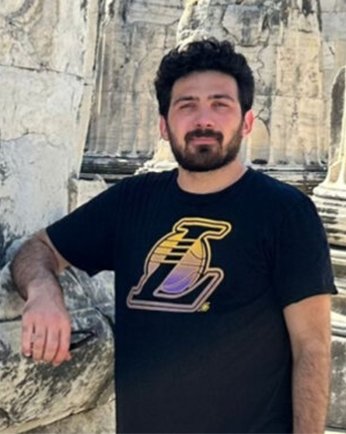
RoofSense: An AI-Based Algorithm for Mapping Roof Types Using High-Resolution Satellite Data
Co-Authors: Zafer Yilmaz (University of California Los Angeles), Riyaaz Shaik (University of California Los Angeles), and Ertugrul Taciroglu (University of California Los Angeles)
Abstract: Vulnerability analysis of buildings in the wildland-urban interface can be significantly improved with comprehensive information about building features. Roof material types are particularly important among these features as they typically have direct contact with the firebrands landing. Due to the complex nature of wildfire exposure and vulnerabilities, conducting detailed fire risk assessment on a large scale is challenging, primarily due to limitations in data availability, financial resources, and time constraints. Therefore, this study aimed to develop a machine learning-based algorithm for mapping roof material types using high-resolution satellite data. Various machine learning algorithms were tested, and XGBoost was selected as the best model for this purpose. To train the ML model, CAL FIRE Damage Inspection (DINS) Data was used as ground truth, with training conducted using 8 bands of Planet Super Dove imagery and its derived features. The developed model successfully predicts roof material types—concrete, asphalt, tile, wood, and metal—with an overall accuracy of approximately 86%. While the targeted application of the developed ML model is wildfires, its output can be useful in the risk assessment of other hazards.

Graduate Student Researcher
Washington State University
A Stochastic Subset Selection Approach for Efficient Regional Wildfire Risk Assessment
Co-Authors: Ji Yun Lee (Washington State University) and Abdel-Aziz Sanad (Washington State University)
Abstract: Regional wildfire risk assessments necessitate simulating a wide range of possible fire scenarios, reflecting uncertainties in ignition, behavior, growth, and containment. These scenarios produce diverse outcomes, enabling a comprehensive probabilistic analysis but requiring significant computational resources. To address this challenge, we propose a novel cluster-based active-learning methodology for effectively selecting a stochastic subset that captures the variability across all potential wildfire scenarios without requiring the full set of simulations. The primary goal is to ensure that the wildfire hazard curve derived from this subset closely matches that from the full set. Specifically, our strategy focuses on achieving accuracy not only for the entire area but also for individual spatial units within the area.
Our methodology integrates the unsupervised learning technique of clustering (e.g., k-means clustering) with the targeted, efficient strategies of supervised active learning to overcome the shortcomings of active learning: (1) a random initial training set that can slow the learning process; (2) an inability to focus on both macro and micro scales; and (3) a lack of event probability assignment. In this presentation, we will (1) introduce the procedure for converting wildfire scenarios into data points in an N-dimensional space, (2) describe how the clustering process can segment these scenarios into clusters based on their potential consequences to the study area, and (3) demonstrate how the process of active learning will be guided and enhanced by clustering techniques, which can make the sampling process more efficient and effective.

Assistant Professor
Johns Hopkins University
Advances in modeling of wildfire impacts on reinforced concrete infrastructure
Co-Authors: Negar Elhami Khorasani (University at Buffalo)
Abstract: Wildfire resilience at the wildland-urban interface (WUI) is closely tied to the performance of physical infrastructure. In particular, reinforced concrete (RC) structures, which are used for bridges, schools, hospitals, and other critical infrastructure, may suffer damage during wildfires, rendering immediate reoccupation impossible. However, gaps in knowledge and modeling, particularly regarding the impact of fire decay phases on RC structures, and the absence of robust post-fire damage assessment protocols and repair strategies, hinder risk assessment simulations and recovery efforts. This research proposes the development of a comprehensive computational method to simulate the performance of RC structures exposed to wildfire. The model captures damage throughout the fire event to assess the post-fire damage state. The approach is grounded in recent novel experiments collecting data on concrete material and structural response under heating and cooling, as well as associated computational models for constitutive behavior and finite element analysis. The models enable simulation of thermal-structural behavior of RC structures under wildfire, including capturing delayed loss of load-bearing capacity and stability during the fire’s decay phase, and how locked-in thermal stresses and irreversible damage affect the residual capacity of RC elements. The models can be used to construct wildfire fragility functions, correlating damage indicators with residual capacity and potential for reuse. Thermal exposure, damage indicators, and engineering demand parameters for wildfire will be discussed. The outcomes will enhance computational tools for simulating wildfire-induced damage and predicting recovery times, ultimately supporting improved resilience at the WUI.

Professor
Oregon State University
Human-centered Computational Approach to Social-technical Wildfire Resilience Research
Co-Authors:
Abstract: This paper presents a human-centered approach to the interdisciplinary social-technical resilience of wildfires. This talk will leverage the authors' ongoing research using three case studies including the 2018 Attica wildfire, Greece; the 2020 Almeda Fire in Ashland, OR and the 2023 Maui wildfire to illustrate how a computational and interdisciplinary agent-based wildfire modeling framework can help address the social-technical system resilience by using empirical data to drive models.

PhD Student
UCLA
Vulnerability Analysis of Buildings In WUI using High-Resolution Satellite Data and Interpretable Machine Learning
Co-Authors: Riyaaz Shaik (University of California Los Angeles), Patrick Hadinata (University of California Los Angeles), Fernando Bardales (University at Buffalo), Negar Elhami Khorasani (University at Buffalo), and Ertugrul Taciroglu (University of California Los Angeles)
Abstract: Over the last few decades, human civilization has experienced significant growth, which has led to climate change and rapid land-use changes. These factors have disrupted fire patterns, causing more intense wildfires. Particularly, the rapid expansion of the wildland-urban interface (WUI) is a major concern due to the unique fuel and human activities that increase fire vulnerability. While significant efforts have been made to predict fire spread and assess risks using wildfire simulators, evaluating individual building risks is crucial to minimize losses. This research project uses machine learning to develop a fire vulnerability rating based on building attributes and the surrounding environment. The study uses data from the 2018 Camp Fire and the 2021 Marshall Fire as the basis for the rating. Building features such as roof material type are derived leveraging high-resolution satellite data and machine learning with an overall accuracy of ~85%, while other attributes are inferred from the National Structure Inventory dataset and Microsoft building footprint. To map the surrounding vegetation, an object detection and instance segmentation model is used to map the surrounding vegetation Anto detect and segment tree crowns from satellite imagery with an overall mean error of 8%. With all these features, a boosted tree-based machine learning model is trained to predict damage outcomes, achieving a ~74% accuracy in predicting the actual damaged buildings. Finally, the vulnerability rating is developed by interpreting the machine learning predictions using SHapley Additive exPlanations (SHAP) values and deriving features' importance.