
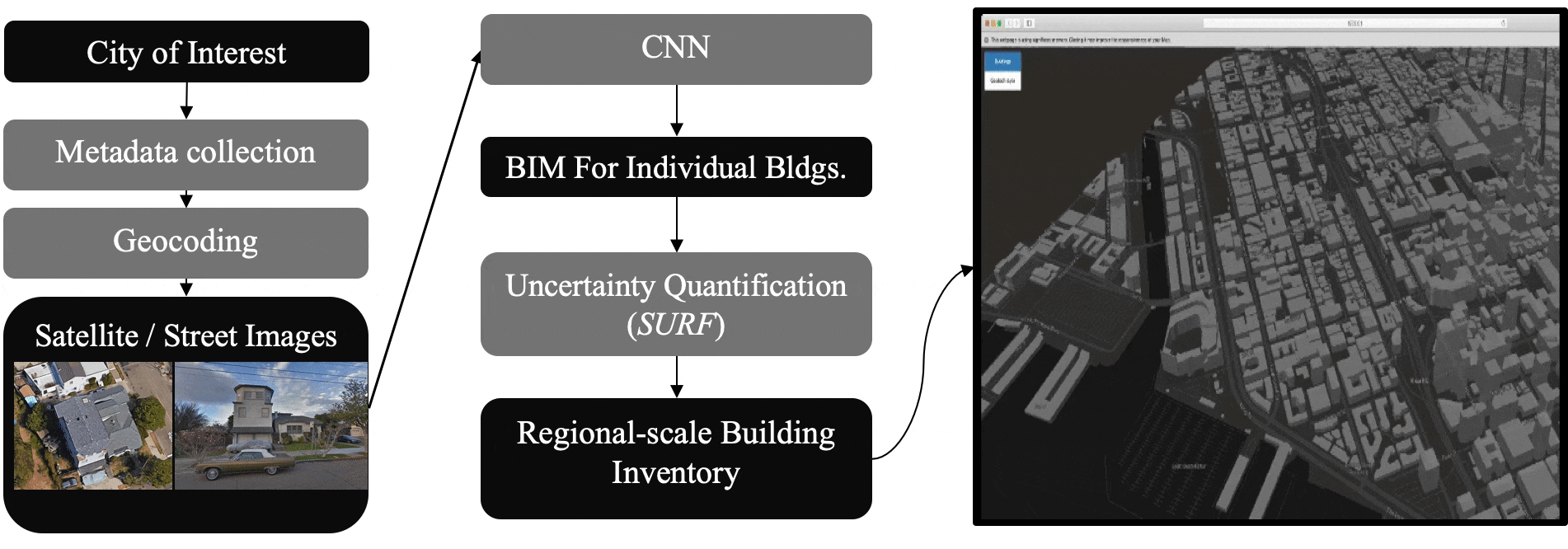
BRAILS is a new AI-enabled tool to assist regional-scale simulations. BRAILS utilizes machine learning (ML) and deep learning (DL) to create enhanced building inventory databases of cities. Examples of its capabilities include: (a) The identification of roof shapes to improve the damage and loss calculations for the hurricane workflow. This implementation used data from open street map and images from Google Maps. (b) The identification of soft-story buildings to improve models in earthquake workflows. This implementation used engineering knowledge and a subset of images from Google Street View to train a neural network to automatically classify the remaining images.
"Regional-Level Building Inventory Generation for Natural Hazards Studies Using BRAILS"
Dr. Barbaros Cetiner, January 27, 2023

Join the User Forum Conversation:
Software Insights:
Current Capabilities
Future Plans
How to cite:
Barbaros Cetiner, Charles Wang, Frank McKenna, SaschaHornauer, Jinyan Zhao, Claudio Perez, & yunhuiguo. (2024). NHERI-SimCenter/BRAILS: Version 3.1.2 (v3.1.2). Zenodo. https://doi.org/10.5281/zenodo.11093530
Deierlein, G.G., McKenna, F., et al. (2020). A Cloud-Enabled Application Framework for Simulating Regional-Scale Impacts of Natural Hazards on the Built Environment. Frontiers in Built Environment. 6, 196. doi: 10.3389/fbuil.2020.558706.